

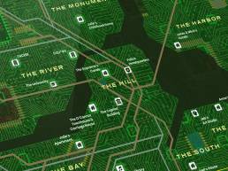
I’m a map artist, making custom, unique imagery for print or pixel, usually delivered as a PDF. I specialize in map illustrations for locations and publications.
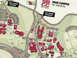
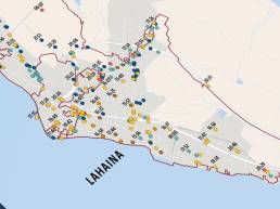
I’m stretching the word “location” here to mean many things, from wayfinding at campuses, facilities, and events to hospitality and tourism, to promotion and education by nonprofits and neighborhood associations. Maps for any of these purposes must be intuitive and accessible reference tools, created to help users find out what they need to know and get where they need to go as quickly and easily as possible. I love to create stylish and beautiful digital map illustrations—branded to match a client’s visual identity guidelines—that invite viewers to visit and experience the places those maps depict.
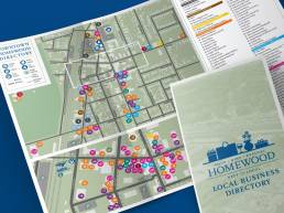
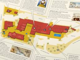
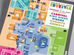
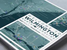
Below are examples for hotels (hospitality promotion and wayfinding), nonprofit associations (used in branding, collateral, and fundraising campaigns), county fairgrounds (event promotion and wayfinding), college campuses (used as both online reference and physical wayfinding), and local commercial promotion (a realty welcome package; a proposed business association).
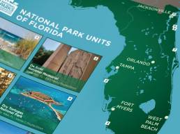
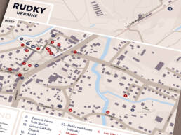
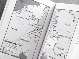
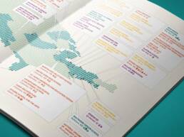
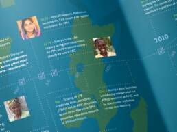
Keirtography for publications helps authors convey their stories or articles with a visually compelling, easy-to-understand reference map graphic.
I have decades of publication layout design experience (magazines, annual reports, research journals, self-published novels, and more), so I understand how these image assets will be used, either by the author themselves, their layout designer, or their print vendor—and I can optimize these maps for any physical or digital format.
Below are five recent examples of my map illustration for publications, as well as a sixth that’s quite old but was an important professional milestone for me.
I also make my own worldbuilding and map art projects. See some of them in my passion project portfolio!