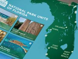
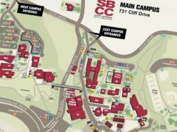
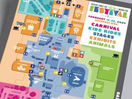
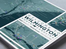
I’m stretching the word “location” here to mean several different things, from wayfinding at campuses, facilities, and events to promotion and education by nonprofits and neighborhood associations. Maps for any of these purposes must be intuitive and accessible reference tools, created to help users find out what they need to know and get where they need to go as quickly and easily as possible. I love to create stylish and beautiful digital map illustrations—branded to match a client’s visual identity guidelines—that invite viewers to visit and experience the places those maps depict.
Below are examples for nonprofit associations (used in general branding, event collateral, and fundraising support campaigns), county fairgrounds (event promotion and wayfinding) college campuses (used as both online reference and physical wayfinding), and local commercial promotion (a realty welcome package).