

Project
Map illustrations of Wilmington, North Carolina and environs for inclusion in client welcome packages produced by Nest Realty’s Wilmington office.
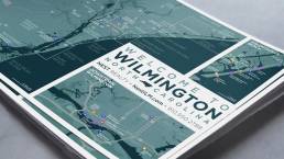
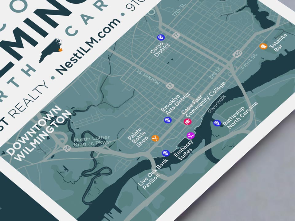
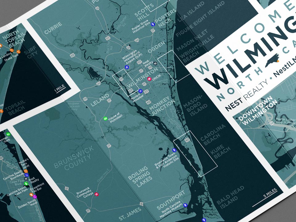
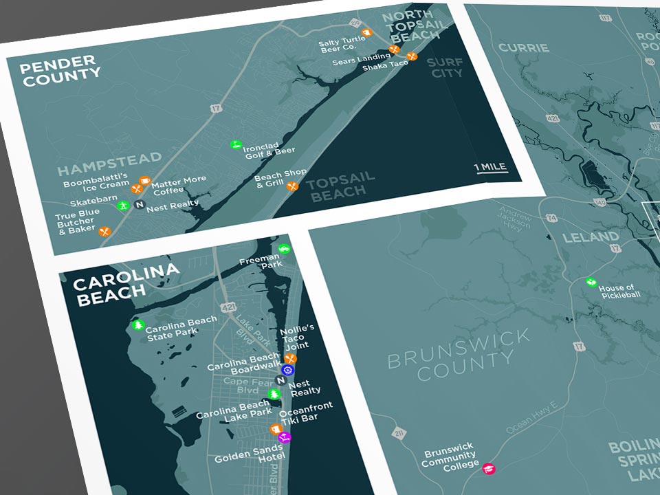
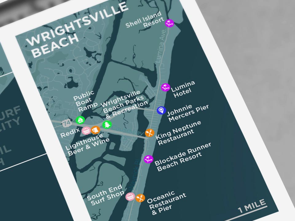
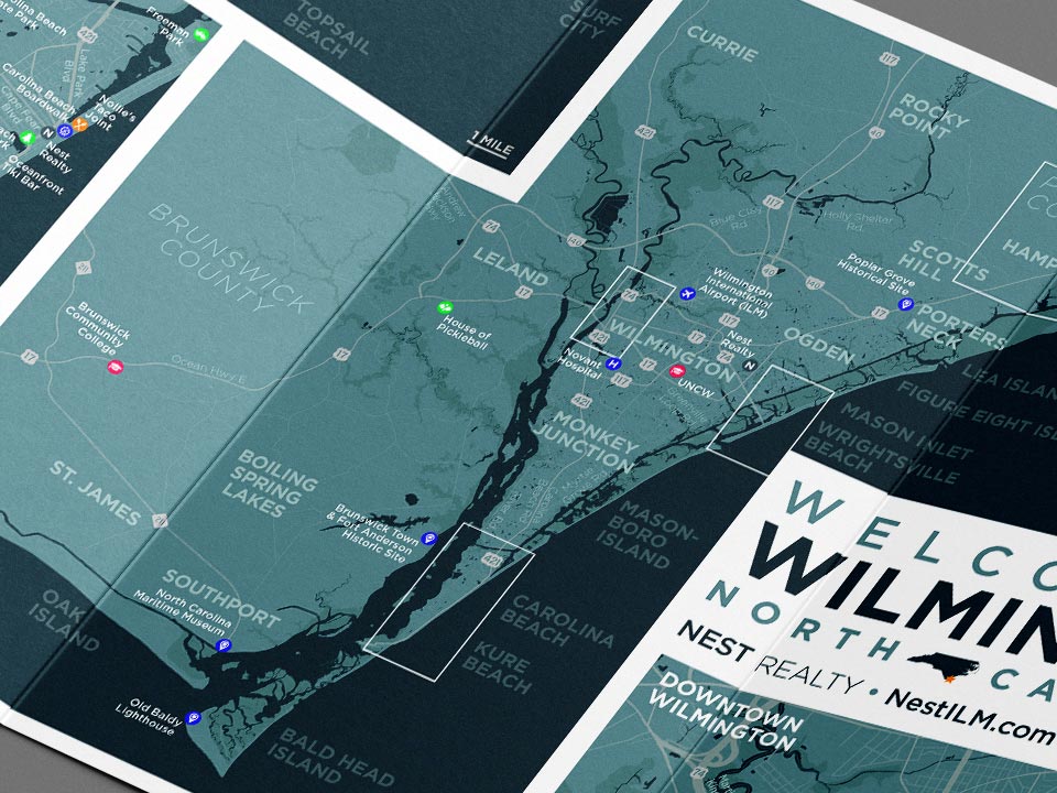
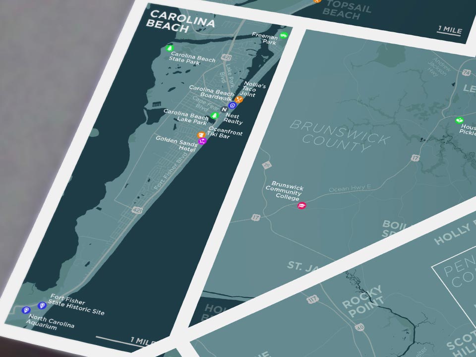
My task was to create a full-color vector map of Greater Wilmington (parts of New Hanover, Brunswick, and Pender counties), including four insets for Carolina Beach, Wrightsville Beach, Pender County, and Downtown Wilmington, highlighting specific points of interest for prospective home-buyers new to the area.
This is effectively a five-in-one piece, so real estate is at a premium (pun intended) and contrast, accessibility, and usability are paramount. The map’s flat, monochrome design allows it to appear more professional, similar to maps for municipal or corporate entities, instead of hand-drawn illustrations more appropriate for tourism or events.
Both the main map and all four insets were styled with typography and color palette that matches Nest’s brand identity as presented in their other collateral and welcome package material. The iconography, however, is brighter and more colorful to make it stand out despite small sizes.
Components
Print: Full-color, branded, vector- and pixel-based print-ready versions
Digital: Full-color, branded, carefully-compressed digital PDF versions
Wilmington Welcome Map Illustration
Digital map illustrations of Wilmington, North Carolina and environs for inclusion in client welcome packages produced by Nest Realty’s Wilmington offices.
ClientNest RealtyServicesMap Illustration (Print, Digital)Year2023