

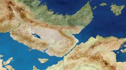
Projects beget projects. That’s not exactly breaking news to most creative professionals, but it’s wisdom I rediscovered when wrapping up my “Homeworlds” Instagram series. I’d used smartphone imaging apps in unintended ways to mash up found textures with digital manipulation, creating something new yet familiar: faux-satellite map aerial imagery. I also learned a few inspiring lessons about scale and perception.
Those lessons inspired me to revive and enrich a semi-dormant fictional map project of mine that had languished for decades. I started immediately, and though in two months I’ve only completed what amounts to Stage One, it’s been so creatively satisfying that I had to document the progress. Before I dig into the process, though, humor me with some context: an extremely niche and nerdy backstory.
Tumbling Dice
I played Dungeons and Dragons as a tween and early teen in the late ’80s. Growing up on stories about Merlin and hobbits (and then video games like Legend of Zelda, Castlevania, and Final Fantasy) made dice-throwing role-playing games a predictable next step, but that didn’t last long. I only truly loved one specific aspect: maps of made-up worlds begging to be explored, so I made maps for every campaign I joined. Eventually, I compiled them into regional and world maps.
I held on to those old D&D campaign maps for thirty years, despite school, sports, college, rock bands, relationships, jobs, everything. I’d dig them up whenever popular culture swung toward fantasy, but reflected energy from Lord of the Rings or Game of Thrones wasn’t enough to keep my attention for long. The maps limped through each spasm of interest, but working at my own pace for my own reasons was fine as long as I made progress and abandoned what wasn’t working.
By about 2017, there were only two remaining hurdles: realistically expressing a physical fictional world, and establishing place-names with linguistic logic but also accessibility. It had to look like a real place and it had to mean something to a non-nerd audience. The names would take time, but I knew that found textures could work wonders for the physical map.
Getting Physical
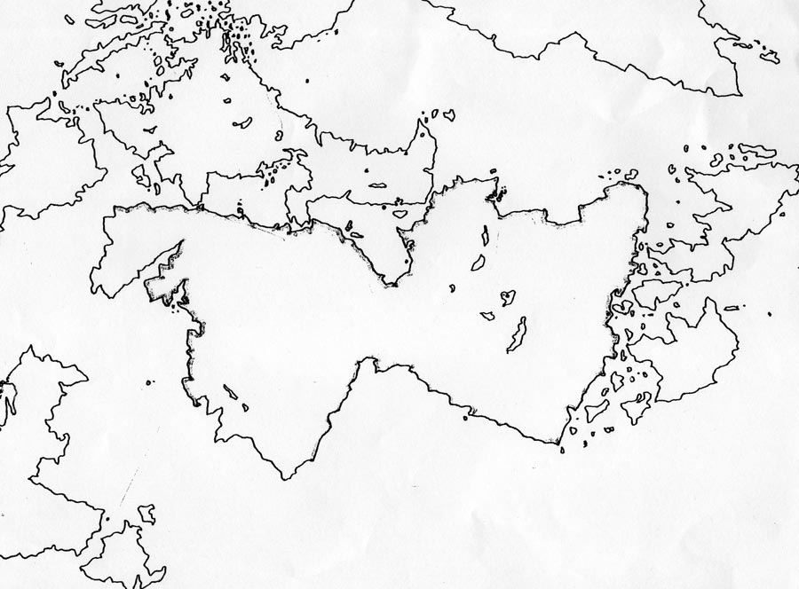
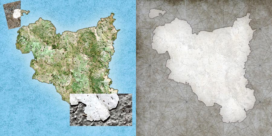
I tackled landforms first, because even nameless physical maps could be compelling. I had a world map outline from earlier in the project’s history, but my main focus had always been a “game board” of four separate but neighboring regions, and it was high time to definitively establish what those looked like.
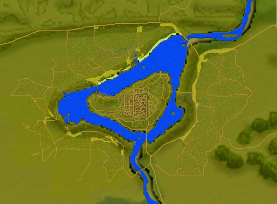
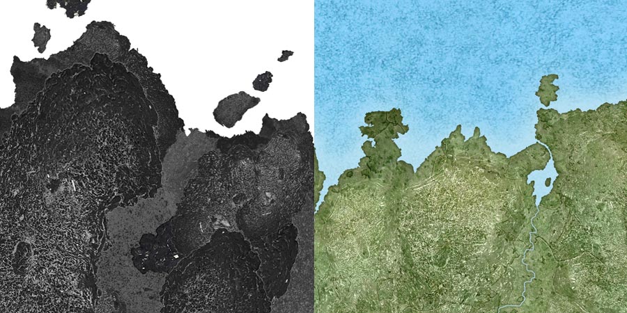
My maphead brain began firing on all cylinders when I applied the found texture ideas to a weird island-shaped tar blob from my garage. It proved an interesting complement to the final “Homeworlds” image, and after a few style and distortion filters they both vaguely resembled two made-up islands from my fictional maps. That worked so well that I moved on to other islands (using paint chips instead of tar), which came alive with exaggerated relief.


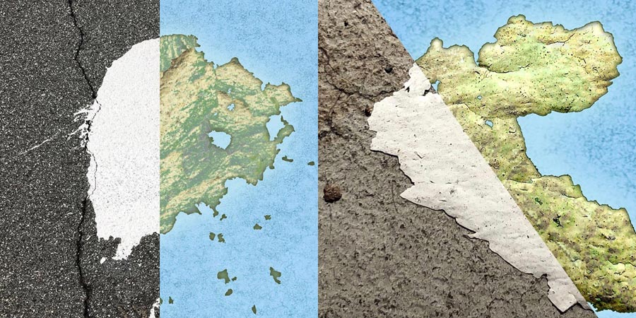
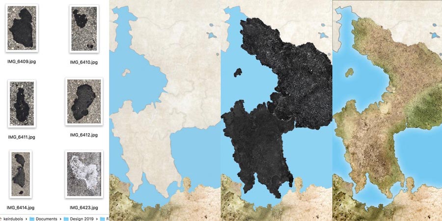
A few weeks later, walking my bike home after a flat tire, I collected a galaxy of roadside debris imagery: pavement, tar, oil, and cement. Those textures already had natural-looking, small-scale features resembling wind, weather, and erosion—so I developed a process to edit them in Photoshop. I’d cut out a shape with a sharp-feathered edge (0.5 or 1.0), then place on the existing base map shape or supersede that with a new shape.
Some samples mimicked elevation well, so I used those again and again—for plains and deserts or alternatively, hills and mountains. That didn’t get repetitive because my deliberate distortion and scaling made the samples match the base landforms. The final few regions went fast but ended up looking great.
Tipping the Scales
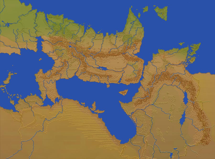
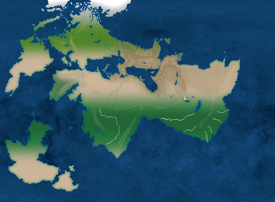
I had to work region by region to get around two problems: scale and file size. Scale was arbitrary at first, but adhering to a few basics wasn’t hard. One island reminded me of Sicily, so I made it the same size, scaling the rest of Europe against my map based on that.
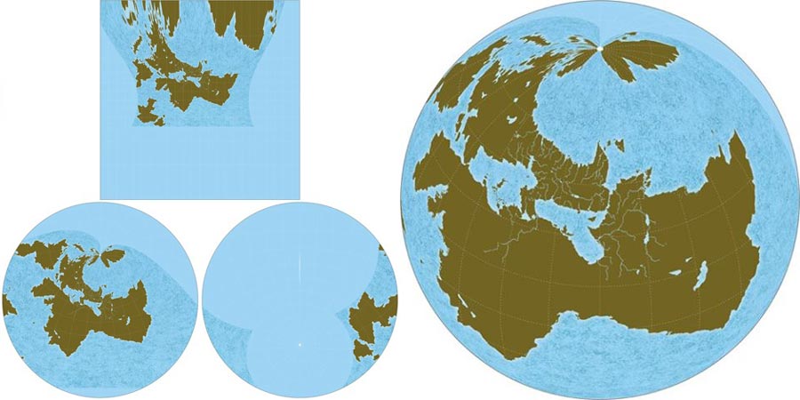
For convenience’s sake I decided this planet’s size and distance from its sun matched Earth’s, so longitude/latitude and weather/climate could also be similar. My rough world map seemed like a close match to the Robinson projection, and a quick session with NASA’s awesome G.Projector app confirmed that.

Getting the level of detail I wanted required a huge base map, and the file size became too big to work with as a whole, so I broke it up into subregions and recombined them upon completion into a single, flattened file. I started with outlying regions first, the “here be dragons” bits, to get detailed in areas I’d ignored or disregarded in previous versions.
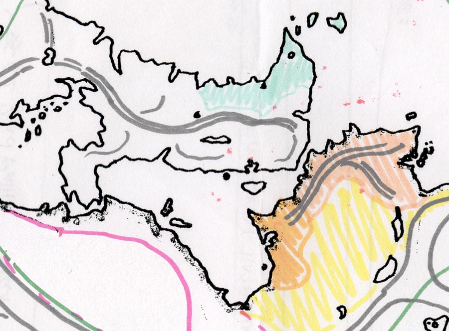
From there I standardized climate zone appearance—arid vs. wet or high vs. low elevation—with Photoshop tools like hue/sat, auto contrast, brightness, and sharpness for refining color texture. I used darker green for low-lying or flat river valleys, lighter green for moors or plains, and beige or brown for hills and mountains.
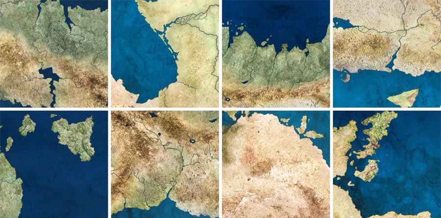
I also had to delve into earth science and physical geography to remember why features appear the way they do, or which features naturally occur near each other. It was a critical step to help me move beyond conventional forest-mountain-desert-plain sameness and make each area distinct. Staring at the Living Earth poster for reference definitely came in handy!
Flipping the Script
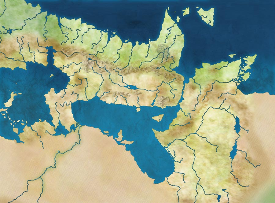
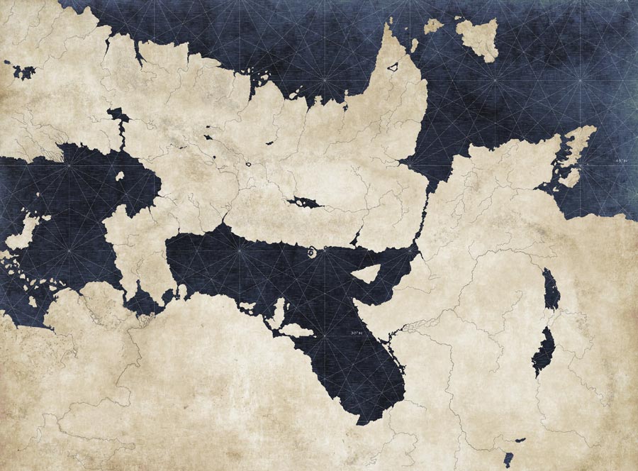
Relying on geology and geography was also a way to keep things weird while avoiding the usual fantasy map clichés. For better or worse I’m a shape snob, and I find most fantasy map landforms ridiculously boring. Distinguishing my map from Middle Earth or Prydain or Westeros or Hyrule—let alone the zillion other fantasy maps out there—required deliberately flipping the script on standard assumptions and tired tropes alike.
My favorite definition of sci-fi or fantasy is that it’s just like our reality, but with one or two major changes (Magic exists! Space travel is real!), so that’s what I tried to do. I flipped my planet’s rotation, literally reversing compass directions, so the map’s Europe-like location faces sunsets over an eastern ocean, and weather (or volcanic ashfall) moves westward.
That one simple change has already been enough to inspire plenty of originality (see below), but I also wanted to avoid the amateur move of basing any landforms on existing places. This wasn’t always possible—did you notice the leftover real-world coastline earlier in this post, thanks to my 13-year-old 1989 brain?—but ideally this map’s shapes are 99% original and aesthetically pleasing.
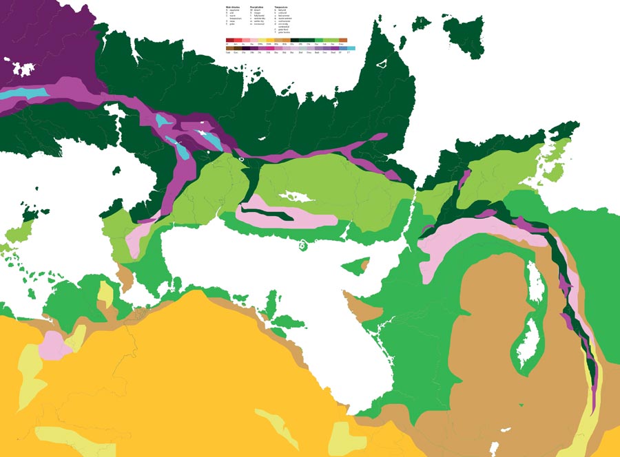
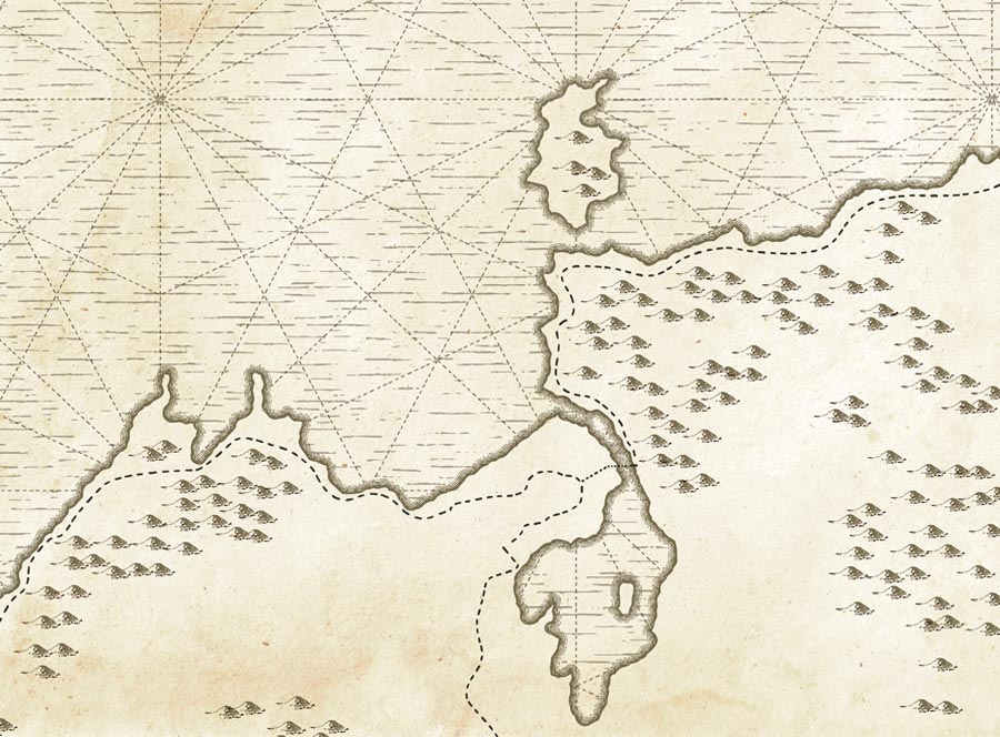
It’s definitely versatile, though; this year’s map is already working well enough to spin off various alternate visual themes. Old-timey nautical parchment, Köppen-style climate classification, and Penguin-Historical-Atlas are only three auxiliary styles I’ve begun creating. However, all of those will hit the same unavoidable wall at some point: place names. That’s beyond this particular post, but it’s a good pivot point toward the next phase!
What’s in a Name?
Disrupting other genre clichés, like race and culture, will have to come in the project’s next phase—place names, language, and history—which has proven more difficult for me than building a planet. However, there are great examples out there to emulate. I almost don’t want to ruin these pretty maps with words, but on the other hand, they’re superficial without place-names. Nameless maps can contain pretty shapes, but they have no stories.
I definitely care about the people inhabiting the places on those maps; culture and society is what I’ve always been most interested in when it comes to geography. Physical geography and geology (and paleogeography!) are fascinating and I love them, but ultimately those shapes, features and places mean nothing without the people living in them. Oh sure, a place can be meaningful if it’s empty or lifeless, but human geography is vibrant, messy, complex, and constantly changing, and to me that’s what makes maps compelling.
Researching real-world places and languages has been inspiring so far. Making up names based on that, and names that aren’t appropriative or otherwise lazy, is a great challenge. It’s breathing life into corners of these maps that I’d never cared about in previous iterations of this project. I don’t know when this will be finished, but I promise it won’t be boring. Stay tuned for updates when it comes alive with history!